Rainfall Totals: Friday Was A Soaker For Parts Of North Dakota
The Bismarck Bubble had a leak or two this past Friday, June 9th.
As much as an inch and a half of rain fell in north Bismarck. The same area also received a shot of rain on Thursday evening where once again as much as an inch of rain fell over the same area.
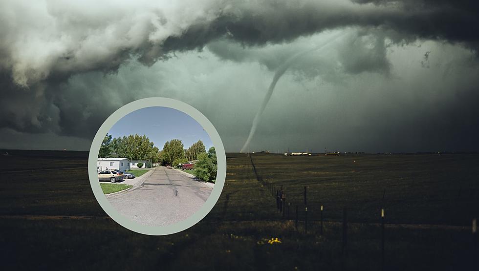
The storms on Friday afternoon that hit the area even produced a funnel cloud that was spotted near Lincoln.
No damage was reported. Some gusty winds and small hail were associated with these storms. This was all part of a pretty potent cold front that brought some relief from the heat and humidity that Bismarck and Mandan experienced last week.
That heat and humidity are expected to return by mid-week this week, where once again we should see temps near 90 degrees before yet another cold front that could bring showers and thunderstorms on Thursday.
Here are your area rainfall totals for Friday, June 9th in North Dakota:
Northwest Bismarck: 1.2 inches of rain.
Bismarck Airport: .20 inches of rain.
Mandan: .60 inches of rain.
Lincoln: .18 inches of rain.
3 miles north of Sterling: 1.7 inches of rain.
Driscoll: .24 inches of rain.
5 miles northwest of Wilton: 2.1 inches of rain.
Breien: 2.3 inches of rain.
Menoken: .17 inches of rain.
New Salem: .29 inches of rain.
Elgin: 1.2 inches of rain.
Flasher: 1.1 inches of rain.
1 mile north of Glenfield: 3.4 inches of rain (the highest total of the day).
Tappen: .55 inches of rain.
5 miles south of Cleveland: 2.3 inches of rain.
3 miles north of Wimbledon: 2.3 inches of rain
Jamestown: .31 inches of rain.
Dickinson: .09 inches of rain.
Belfield: 1.8 inches of rain.
Minot: .18 inches of rain.
LOOK: Popular fashion trends from the year you were born
North Dakota's Top 11 Lakes According To Our Fans
More From 96.5 The Walleye